About 10,000 thunderstorms occur in Ontario during a typical summer and only about 1% of these are "severe" and produce damage or injury. These occur on average 39 severe weather days each summer when something convectively bad happens in Ontario. Of these 39 days, 11 also have tornadoes somewhere in the province.
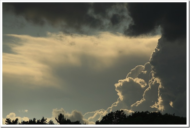 |
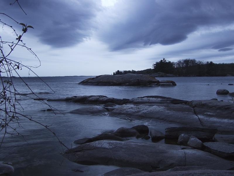
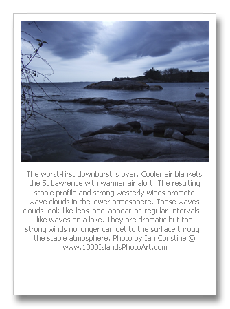
Photo by Ian Coristine © www.1000IslandsPhotoArt.com
|
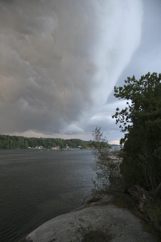
Looking along the squall line. A distant thunderstorm anvil is made of fibrous ice crystals blown by the jet stream. The sharp and hard flanking line of a much nearer supercell thunderstorm denotes the intensity of the associated airflows.
|
Since 1993 an average of 121 severe thunderstorm events have been detected in Ontario each summer on these 39 severe weather days. I have done research using radar and lightning data which would suggest that these detected events are only 10%, plus or minus of those that actually occur each summer. This would indicate that about 1210 events likely occur with the majority going undetected due to vast Ontario expanses of little human encroachment. If a tree falls in the forest does it make any sound? Regardless, the severe event doesn’t make it into the detected events database.
The vast majority of these severe events with an average of 70 per year are downbursts. Downbursts will be the topic of another weather story later this summer. Winds exceeding 90 km/h typically produce damage. Downbursts winds can reach 180 km/h and in extreme cases reach 270 km/h which is the same kind of wind experienced with an Fujita Scale 3 tornado... the Fujita Wind Damage Scale uses the damage done to trees, buildings and vehicles to estimate the wind speed involved in tornadoes and downbursts. The scale goes from Zero (weakest) to 5 (strongest). People are generally disappointed to learn that the damage they witnessed was due to a downburst rather than the more exotic tornado – remember that both can be lethal. [Editor's note: Grindstone Island in the town of Clayton and Cherry Island in Alexandria Bay were devastated by a downburst in .... As a result, Thousand Islanders take these seriously]
There are typically 20 hail events with hail stones greater than 2 cm in diameter (size of a nickel). This size of hailstone will dent cars. The largest Ontario hailstone in recent memory was the size of a softball and fell in Niagara Region on May 31st, 1985 – the same day as the Barrie Tornado.
On average 20 heavy, flooding rainfall events occur each summer with thunderstorms in Ontario. Local geography and drainage play a big part in this.
Finally, there are on average 11 tornadoes a year with most of these in the low end of the Fujita Damage Scale, F0 and F1 categories. F1 tornadoes pack winds up to 180 km/h. There is typically an F2 tornado or two each summer with winds to 250 km/h. F3 and F4 tornadoes are more rare with the last F4 being associated with the tornado outbreak of May 31st, 1985.
There is no doubt that severe weather will occur this summer. The only question is when and where and how severe. These are still tough questions to answer. With the right safety precautions, there is no need for injury with severe convection. The pictures you might take of the severe weather could be your last. I understand that many people want to see a tornado before they die… but not just before they die.
Environment Canada will issue a severe thunderstorm or tornado warning if heavy rain, high winds, tornadoes, hail or intense lightning are present or expected. The Weatheradio network transmits continuous weather information on special VHF-FM frequencies. Compact, battery-powered Weatheradio receivers can be purchased from most electronics stores to monitor these broadcasts. In Ontario, these broadcasts are accessible by 85% of the population. Environment Canada's Weatheradio Web site at http://www.msc.ec.gc.ca/msb/weatheradio/fact_sheet_e.cfm has a complete list of transmitter locations. A Weatheradio is a lot like a smoke detector for severe weather. Everyone should have one and know how to use it.
The storm's expected motion and developments are also provided in the weather warning. If you hear a weather warning and are in the area specified, here are some safety precautions that will keep you and your family safe.
  |
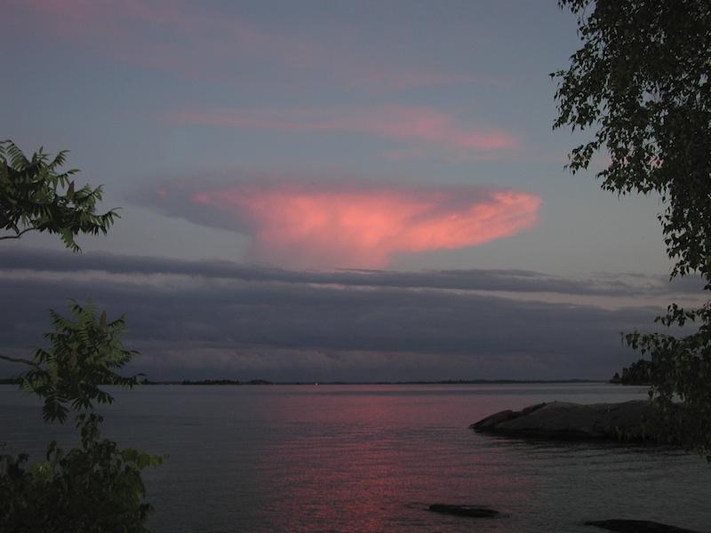
Photos by Ian Coristine © www.1000IslandsPhotoArt.com
|
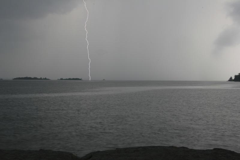
Ian Coristine writes: "This was a five-minute microburst that went through the Thousand Islands last summer that might have been a mini tornado, snapping three mature pines on the western point at Jones Creek like matchsticks and trying to take down one of mine. It didn't get my tree (thank heavens) but lifted the top soil, folded a heavy Adirondack chair and tried to stuff it underground. It was surprisingly far in with at least a foot of chair hidden"
|
General Precautions
Choose a shelter in advance. Good places to be during severe storms are basements, storm cellars or underneath stairs or sturdy furniture in the centre of the house.
If you hear a severe thunderstorm watch for your area, meaning conditions are favourable for the development of severe thunderstorms:
- Secure or put away loose objects such as outdoor furniture.
- Put car in garage or carport if available.
- Bring livestock to shelter.
- Listen carefully for updated weather information. Remember that tornadoes are possible during a severe thunderstorm. Keep this in mind when making your preparations after hearing a severe thunderstorm watch.
If you hear a severe thunderstorm warning, meaning that severe thunderstorms are highly probable or are occurring:
- Keep calm.
- Ensure children are indoors or otherwise safely sheltered.
- Go to your shelter and take along emergency pack.
- If boating or swimming, head for land immediately and seek appropriate shelter.
During a severe storm:
Stay away from all doors and windows if you are inside to avoid injury from broken or flying glass.
Don't travel. If caught in your car, open car windows slightly and park off the road away from tall objects and power lines. Set the brakes. Be wary of downed power lines and don't try to step outside the car if they are near or touching the car.
In the event of a tornado, abandon car and seek a sturdy shelter or low-lying area.
If officials tell you to evacuate, do so. Take emergency pack, supplies and personal documents and identification for each family member.
If caught outdoors, seek shelter in a low-lying area away from trees and free standing objects which may topple over or attract lightning. Be alert for flash floods if you seek shelter in a low lying area or ditch.
When is it over? One can apply the 30-30 rule as a guide. Remember that lighting is associated with all thunderstorms and lighting kills more Canadians (10) each summer than tornadoes. The odds of being struck by lightning in Canada are lower than one in a million but who wants to win this lottery? One lightning guideline is the "30-30" rule: Take appropriate shelter when you can count 30 seconds or fewer between lightning and thunder, and remain sheltered for 30 minutes after the last thunder.
After it is all over and it is safe, there is plenty of time for pictures and to relay the information to Environment Canada so that the event actually gets included into the severe weather database and is not one of the 90%. A new approach this year is the following email address which goes directly to the Ontario Storm Prediction Centre – “storm.ontario@ec.gc.ca”. Your observations will be noted and someone will get back to you as soon as possible. Mention “Thousand Islands Life” and this article so they will know how you discovered this brand new email address (storm.ontario@ec.gc.ca)
Have a safe, convective summer!
by Phil the Forecaster
Phil the forecaster, is a well known as a meteorologist working for Environment Canada and specializing in severe weather forecasting. This is Phil's the second article about the weather. Snow Squalls and Other Joys appeared in February '09. In April we featured Phil's artwork in Artist, Phil Chadwick. Phil's credential's are impressive.
Phil's artworks are depictions of personal experiences. They hang in many private and corporate collections. (One of these is Gallery Streetsville in Mississauga, Ontario). Several magazines and calendars have used his work. Phil is also an occasional writer for Harrowsmith and other nature oriented magazines. Weather stories and art, both from a impressionistic but realistic perspective, get into print as often as possible! He has just completed a book: The Weather of Ontario, which is scheduled for print in 2009.
He works out of an office in Boulder, Colorado, and or in the Toronto office of the Meteorological Service of Canada (MSC) and Environment Canada, However if you are lucky, you will find him in the Thousand Islands or on a river, lake or stream throughout the summer with his canoe and his paints.