Hunched, damp and tired, we look at the scribbled number on the page and debate calling the U.S. Coast Guard. Almost 24-straight hours cramped into a seven-by-seven foot nylon tent, all alone on a 12-acre island in the midst of relentless rainfall and surrounded by white-capped waves, our options are limited. I look at my cousin Claire. Random pine needles and dirt stick to her from shin to toe, the result of running through the woods barefooted in the rain. My friend Bryan, hair wet from brushing against the condensation of the walls, sitting on his saturated sleeping bag. I sit and wonder why I didn’t pay more attention to the weather when planning this trip.
I was inspired once while standing at the downriver edge of Red Top Island years before. I watched with envy as water slowly and steadily progressed away towards the sea. Staring at the labyrinth of waterways between downriver islands, I couldn’t help but wonder - what is there around the bend?
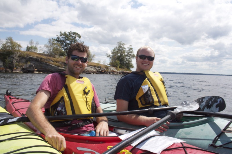
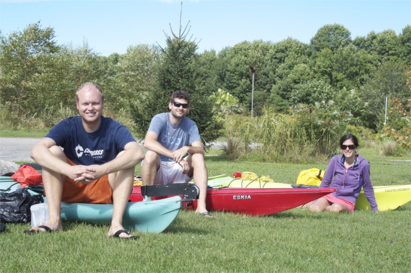
So in an effort to answer that question I’ve recruited my cousin Claire, a college student at Georgian University north of Toronto and Bryan, a coworker of mine at ESPN in Connecticut and a fellow outdoorsman. I’ve decided to take a timeout from my ordinary routine of internet browsing and air conditioning to simply follow the water. With rented kayaks, some basic camping supplies, and a thirst for the unknown we’ve got five days to float merrily downstream.
However when departing on such a leisurely journey it’s probably not the best idea to do so in the rain...between thunderstorms…and with only four hours of daylight remaining. Conditions not hampering our enthusiasm, from Red Top in the Lake Fleet we set off and point our bows towards the clearest landmark we can find – the distant International Bridge six and a half miles away.
Thirty minutes upon rolling waves and sprinkling rain and the sky cracks and echoes with thunder, so we swiftly make land on a private yet unoccupied island and wait it out. When the electricity finally clears the air we decide to push on for another half hour and make our way to “Mulcaster Island”, part of St. Lawrence Islands National Park. On our way we pass quietly through a shallow cove with the post-storm calmness in the air. We see underwater plant life swaying and fish swimming below. We sneak up on gulls and geese perched upon a small shoal, and looking back, our Red Top is long out of view and we realize we’re fully committed.
As if the hours of pruned fingers and feet weren’t enough, we dive off the sloping granite near our campsite for an evening river bath soon after our gear is unloaded and tent erected. With the sun down, some snacks and chatting, we’re ready to call it a night.
Shortly after dawn birds sing and swoop, and all is grey and wet. Getting an early start we point ourselves towards a lighthouse at the far end of the channel, and I try to make sense of our rudimentary maps. In the pale grey, blue and green world upon which we float, crossing the main navigation channel I feel like a turtle crossing a dessert highway – small, slow, and lucky to cross unharmed.
Near the lighthouse we play our new favorite game - quietly creeping close to the perched cormorants and geese upon shoals, before they decide we’ve come too close and depart in a furry. Using American and Canadian flags to help us find the border, we re-orient ourselves and head into the “International Rift” – a narrow river within the river separating the two islands and doubles as a tiny border between the two huge countries.
In the Rift it is very quiet and the air is still. When we stop for a lunch on the Canadian side the forest ground gives-way an inch underfoot because of the rain. We find a spot on solid rock with a decent view of the river and with trees overhead to block the rain drops and we enjoy a lunch of sliced Swiss cheese, bread and fruit.
Continuing on we row under two small bridges, the second lined with northbound customs traffic, and we amuse each other with the strange acoustics and echoes under the bridge. At east end of the rift we find ourselves in the “Lake of the Isles” – a very wide yet shallow body of water which is cut off from the rest of the river, with the exception of the narrow inlet and outlet channels. The weather picks up, the east wind is still blowing in our faces, slowing our progress. Leaving the lake along the waterline we spot a mink – a thin little bugger who darts quickly between the rocks. We slow to check him out, and he slows to check us out. I drift towards the shore and get to within five feet or so, and lock onto his little black eyes. He’s cute. We laugh about how unfortunate it would be to have an angry mink jump into your kayak seat.
Following the north shore of Wellesley Island we make land on a state park to seek shelter from the pouring rain. It’s still early, about 3 in the afternoon, but it’s raining steadily, the wind has picked up and the water is too choppy to continue, so we survey the island and decide to spend the night. We tie our boats to a narrow floating dock which feels more like a sway bridge and set up our tent on a flat spot atop a hill under some trees. We quickly gather some crucial supplies, lay down and take a mid-day nap listening to the sound of wind and rain.
We wake up and it’s still raining. We chat, we brainstorm, and look in vain for some playing cards. It rains. Soon it’s dark, and without much else to do we’re off to sleep, ready to put this day behind us and start anew tomorrow.
The next morning the rain is still falling and shows no sign of letting up. Hearing the wind howl and seeing the river so rough, we decide going out on the water isn’t an option, so we wait it out. Several hours, and a breakfast of Snickers and beef jerky later, the rain keeps pounding and the tent almost gives way to the wind. We haven’t seen Ranger Bill, other campers, or anyone on the water all day, and we fear we might end up spending another night cramped and damp in the same spot.
Needless to say, moral is low. Our sleeping bags, our clothes and supplies, everything seems to be wet and getting wetter, and we talk about giving up and ending the trip. We call Huck’s Marina and ask about a water taxi, but they tell us the river is too rough so they aren’t sending boats out. We feel confined, isolated, and anxious. With the Coast Guard’s number on a notepad, we weigh our options, and formulate a plan. We decide pack our gear and make everything ready to leave, but wait out the weather. If we get a window to cross before the sun begins to go down we’ll hastily make our way the mile or so across the river to Rockport, and spend the night in civilization. If the weather doesn’t clear, we’ll hunker down and wait it out.
Several stuffy hours later the rain patter slows and we happily experience what Bryan calls “Alaskan Sunshine” - a small patch of blue sky breaking through the clouds in a far end of the sky. The adrenaline of seeing our opportunity overcomes our cramped legs, and we bail the rainwater from our boats and quickly make way across the choppy channel. We receive some strange looks from the elderly tourists filing out of a tour boat in Rockport, but are relieved to have escaped our tiny tent. On show after spotting the Boathouse Restaurant we quickly reward ourselves with some tall and frosty beers and some hot food. It feels good to be back on the mainland, under a roof, even using a chair. It also feels good to hear that my aunt and uncle have graciously offered to take us out to dinner and allow us to stay in a hotel room for the night. It’s amazing how much a good night’s rest and a load of laundry to dry our clothes can raise our spirits and by 8:30 the next morning we leave Rockport and head East welcoming something new - the sun!
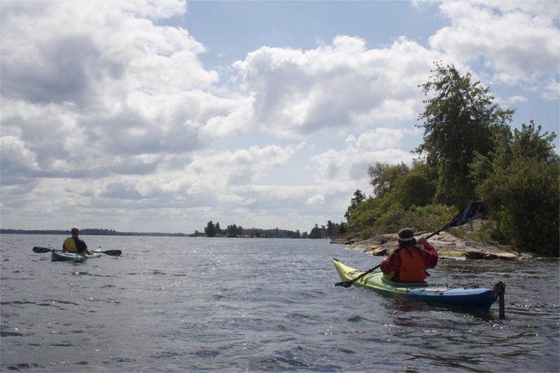
Our final full day on the water is a gem. It’s clear, calm, and beautiful. We use sunscreen for the first time and when we look behind us the International Bridge fades into the distance miles behind. We navigate the main channel, Bryan leading the way, me behind to his right, Claire behind on my left - a perfect triangle we seem form each time we paddle together.
We paddle past classic wooden boats, perched Blue Herons, cold deep channels and shaded coves. We paddle past a group playing 9 at the Grenadier Country Club and joke about how our kayak oars would make great golf clubs if we decided to play a few holes.
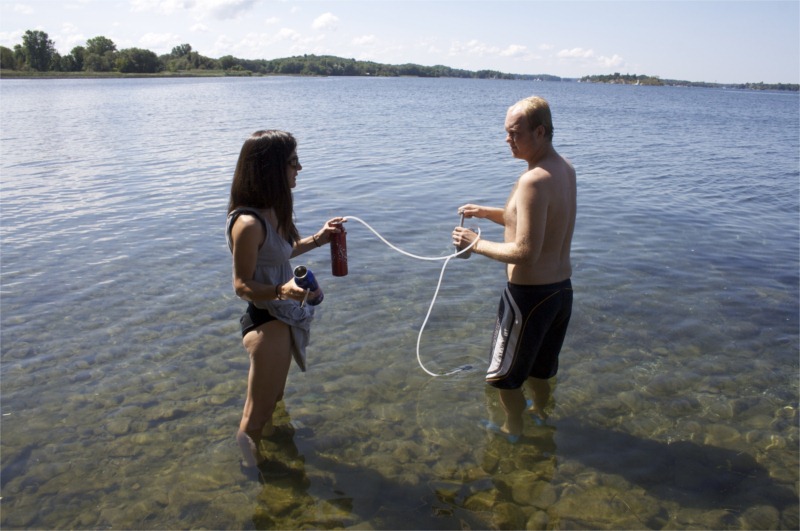
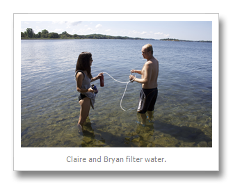
Spotting our new favorite sign, that which marks Parks Canada, we make land on “Squaw Island” to filter water, rest our shoulders and eat lunch. Wondering the island with a crisp green apple in my hand I have a few moments alone where I lay upon a clearing of grass and close my eyes. I’m comfortable and content, and my world is exceptionally calm. Later Bryan and I go for an afternoon swim along the riverbank, taking advantage of the current and drifting along leisurely before mounting up and continuing east. We make our way through shallow marshes and all is bright and green and quiet until the wind picks back up as we round Ferman’s point.
As we continue along each stroke takes more effort than the last. I envisioned this trip as a casual paddle with the sun in our faces and the current at our backs, requiring little more effort than an automatic sidewalk at the airport. In reality it’s required constant work going into the persistent east wind. It feels more as if we’re spending our days peddling bikes with our arms on a slightly inclined slope. It’s a wonderful way to see the river however, the proximity to the water grants us many unique vantage points and our pace allows us to savour the millions of wonders within the Thousand Islands.
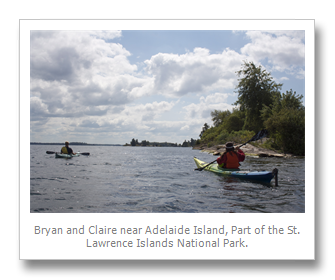
We see the castle on “Dark Island” in the distance and stop for a few hours on picturesque “Adelaide Island” to dry our tent in the sun, stretch our legs and take another swim. This time I spot a solitary loon bobbing upon the water a few hundred feet away and slowly swim towards her. She eyes me within 100 feet, nervously spins within 75, protests loudly within 50, and suddenly dives around 25. Seeing this I promptly decide it’s better to turn around now than risk an unfortunate underwater beak-attack.
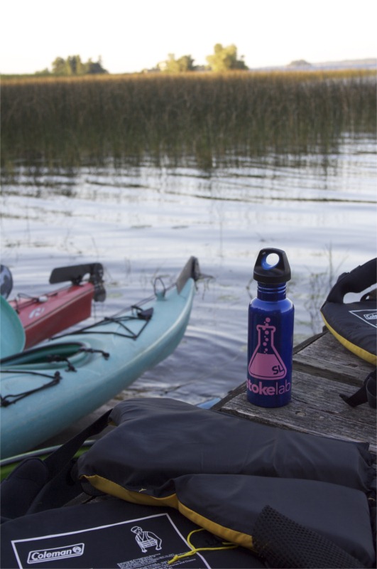
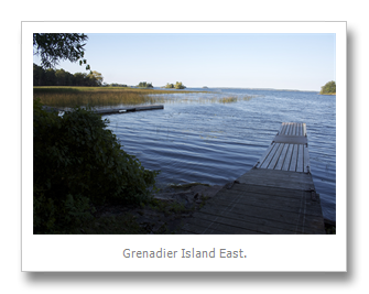
Our final stretch on the water takes us to Grenadier East - a secluded and well maintained campsite at the end of a quiet inlet facing the main channel. I couldn’t ask for a better night on the river than the one we share our last night. The air is clear, we prepare a feast of a dinner, sit around the campfire, talk and watch the full moon rise overhead. As it gets dark we see the blinking red lights marking the channel to the north and some fireworks near Alex Bay to the south.
Looking back on the trip it’s easy to wish some things went differently - the rain, the wind, the cold. The trip went too fast, and things didn’t go quite as planned, but we made it through together, and had some amazing moments. But hey, couldn’t you say the same thing about life? Kayaking the Thousand Islands has its challenges and rewards. On this trip I answered some questions about the river and discovered many more, and I can’t wait to paddle it again.
By Trevor Brightman
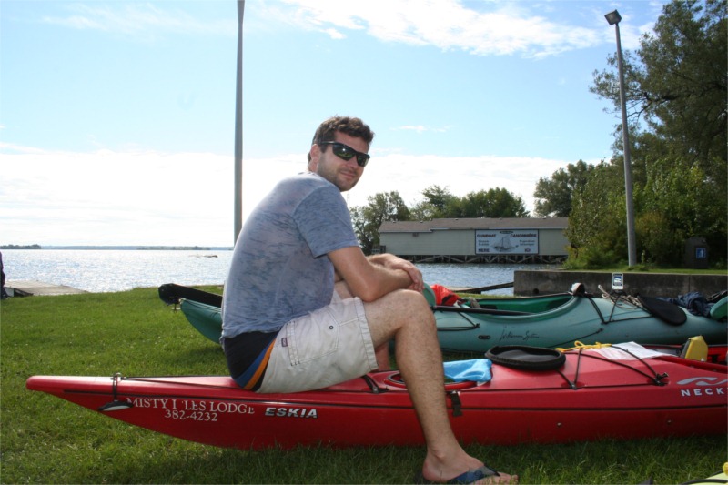
Trevor Brightman, a native of Lexington, MA, is a Graphics Systems Controller for ESPN in Bristol, CT. He has spent every summer visiting Red Top Island in the Lake Fleet, which was purchased by his great grandparents in the 1940s. He holds a BSc. from the College of Charleston, SC, founded in 1770, and a Masters Degree from Connecticut's Quinnipiac University. He enjoys year-round hiking, cooking for groups of family and friends, and writing about his travels.