Written by
Kara Lynn Dunn posted on July 13, 2017 12:34
|
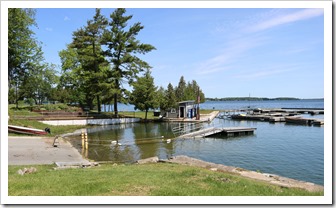
Cedar Point State Park, Clayton, NY
|
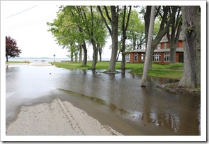
Street flooding, Cape Vincent, NY; June 2017 Photos by Mary Austerman, New York Sea Grant
|
Report High Water Impact or Not
An electronic survey to report the impact of high water is now online for property owners on the New York side of the St. Lawrence River. Those without impact to report are also invited to complete the survey developed by Cornell University with rapid response funding from New York Sea Grant.
“This survey effort is in response to stakeholder requests for a standardized method to collect, report, and document the impacts of high water levels on waterfront properties, including erosion, damage to natural and manmade shoreline protective features, and business disruption,” said New York Sea Grant Coastal Community Specialist Mary Austerman.
Survey analysis will identify areas that are most vulnerable to high water levels. The data collected will be reported only in aggregate; individual addresses will not be identified.
|
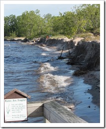
Dunes along Lake Ontario seen from a flooded walkover.
|
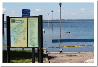
A St. Lawrence River access walkway under water in Cape Vincent, NY; June 2017. Photos: Brian P. Whattam
|
“The information gained from these surveys will help New York’s Great Lakes and St. Lawrence River communities strengthen their capacity for future resiliency,” said New York Sea Grant Associate Director Katherine Bunting-Howarth.
Cornell University Assistant Professor of Biological and Environmental Engineering, Dr. Scott Steinschneider and Cornell University Professor of Natural Resources, Dr. Richard C. Stedman, developed impact surveys for New York’s Lake Ontario and St. Lawrence River regions. Residents of the Sodus Bay area, along Lake Ontario, helped to test pilot the initial survey for the lake area.
|
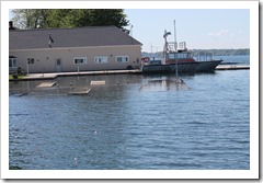
Docks under water near the Pilot Boat at Cape Vincent.
|
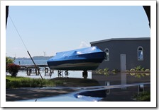
Boat under wraps.
|
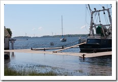
NYS DEC Fisheries Research Vessel Seth Green; all in Cape Vincent, NY; June 2017. Photos: Brian P. Whattam
|
Survey responses will be accepted through August 31, 2017. Access to the surveys is online at www.nyseagrant.org/waterlevel2017.
For more information, contact Mary Austerman at 315-331-8415 or mp357@cornell.edu or visit the Facebook page at www.facebook.com/NYSGCCD.
New York Sea Grant is a cooperative program of Cornell University and the State University of New York, and one of 33 university-based programs under the National Sea Grant College Program of the National Oceanic and Atmospheric Administration. New York Sea Grant maintains Great Lakes regional offices in Buffalo, Newark and Oswego. For updates on New York Sea Grant activities statewide, www.nyseagrant.org has RSS, Facebook, Twitter and YouTube links.
By Kara Lynn Dunn
Kara Lynn Dunn is the publicist for the New York Sea Grant Great Lakes Program. She lives in Mannsville, NY, with her husband and photographer, Brian Whattam, who grew up in Three Mile Bay, NY. Kara earned a journalism degree at the University of Pittsburgh; is a freelance writer, publicist, and designer; and has authored two books on North Country natural and historic sites. Kara vividly recalls childhood camping adventures, along the St. Lawrence River, with the Village of Mannsville Summer Recreation Program. See Kara’s other articles here.