Anyone who knows the Mondores also knows that my husband and I love to hike! And we especially love to hike the Thousand Islands. Over the past several years we have made it a point to hike as many trails in the area as possible. What has been most amazing to us is that even though we have been spending our summers at the river for almost 30 years, it was only a few years ago that we began to discover just how many awesome hiking t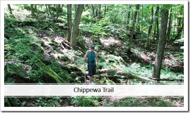 rails there are in the area. And just when we think we've discovered them all, we keep discovering more.
By the end of last summer we had hiked a pretty significant number of local trails. And of course every time we discovered a new trail, it immediately became our new favorite that we needed to tell everyone about. We were quite surprised to find that in addition to the tourists and visitors, many of the local residents seemed to be completely unaware of some of the extraordinary beauty that is practically right in their own backyards. 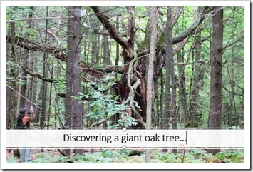
In fact, some close friends of ours commented that we ought to put a list together sometime of all of the parks and trails we had hiked in the area. So, last winter we took those words to heart and began to work on that project. In January, we took the list of our favorite hiking trails and started a series of hiking blogs on Bob’s singercastle.blogspot.com. By summer, the list has become fairly extensive and it seems we are still continually discovering new trails all along the border from Cape Vincent to Ogdensburg. We would note, especially to our Canadian readers, that this list only represents hiking trails on the US mainland.
Since we realized that pretty much anything important that relates to the River eventually appears in Thousand Islands Life, we thought we should share our list with its readers. We figured our list might be helpful, not just to those visiting the area, but also to some of the local River Rats who may not have known about all of the beautiful spots so close to home where they can escape to (hiking, by the way, is also a lot less expensive than fitness center memberships).
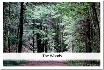 And as we find new trails, you may just see us add them to the comments section (and of course to our blog). If you visit our blog you can also find links to trail maps for many of the trails listed below along with a growing list of more detailed trail descriptions along with some of our favorite photos. You will note that the majority of our hikes are at State Parks, the Thousand Islands Land Trust (TILT) and Indian River Lakes Conservancy.
Please feel free to let us know of any trails we might have missed (we’d love to go hike them in addition to adding them to our list)! But for now, grab your walking sticks, bug spray, and hiking shoes, and let's head out to the woods! As we do, I would like to share the words to one of my favorite songs. This is the second verse of the old hymn, “How Great Thou Art” and it comes to mind every time we take a hike in a beautiful place.
“When through the woods, and forest glades I wander,
And hear the birds sing sweetly in the trees.
When I look down, from lofty mountain grandeur
And hear the brook, and feel the gentle breeze.
Then sings my soul, My Savior God, to Thee,
How great Thou art! How great Thou art!”
- "How Great Thou Art" - Carl Gustav Boberg, 1885.
On that note, here is the latest version of Bob and Patty’s Most Excellent Thousand Islands Hiking Trail List with a few field notes. I have tried to order them in a somewhat East to West order. We will include direct links to each blog for directions and more pictures of each trail. Let’s head out to Ogdensburg for our first hike.
Maple City Trail. We will start in Ogdensburg with an easy Deet-free hike down the 2.2 mile Maple City Trail. There are numerous access points to the trail so one can pretty much do as long or as short a hike as they would like. The trail starts near the waterfront at the Ogdensburg Visitors’ Center at 100 Riverside Ave and then wanders alongside the lovely Oswegatchie River. It goes over, under, and across several bridges along the way actually taking hikers over the Spring Street Bridge and then along the southern shore of the river, under Rte 37 ending at an old railroad trestle. There are lovely sites to see all along the way.
http://singercastle.blogspot.com/2018/07/hiking-maple-city-trail.html
Abbe Picquet Trail. This historic waterfront trail had their ribbon cutting on 7/7/18 so it is brand new. It is a one-mile walking trail at the former site of a French fort (Fort de la Presentation) built in 1749. It is located on Van Rensselaer Point in Ogdensburg. We loved the hike and also the best view of the lighthouse we have ever had!
http://singercastle.blogspot.com/2018/08/hiking-abbe-picquet-trail.html
Red Barn Preserve Trail. This trail is so new, I had to resubmit this article to add it. The Morristown Red Barn Preserve Trail opened on May 26th. It has not even had a formal grand opening yet. It is an amazingly beautiful trail winding through a variety of terrains, and includes a 300-foot boardwalk over a marsh with an active heron rookery within sight. It is located on River Road East just outside of Morristown. Please visit our blog for more details.
http://singercastle.blogspot.com/2018/06/hiking-morristown-red-barn-preserve.html
Jacques Cartier State Park. I have no idea why we never stopped into Jacques Cartier until only recently. It is not only a wonderful park with an amazing view of the river, but has several wooded hiking trails with streams and waterfalls, which are absolutely delightful. Start with the Krooked Kreek Trail though be prepared for a couple of interesting Kreek Krossings.
http://singercastle.blogspot.com/2018/06/hiking-jacques-cartier-state-park.html
Chippewa Bay Preserve. The trail in Chippewa Bay was only opened to the public in the past year or so. It is a little over a mile loop and is another TILT property. It is a lovely and peaceful hike in the woods on a not-too-well-worn, but well marked path. The trailhead was a little tricky to find, so you might want to check our blog for more details. We love the Chippewa Bay Preserve trail!
http://singercastle.blogspot.com/2018/05/hiking-chippewa-bay-preserve-trail.html
Lonesome Bay State Forest. This lovely State Forest is located in Hammond, and we have heard it is also accessible from Black Lake. There are no hiking trails, but a two-mile long access road going straight through the middle of the forest. It passes through a variety of terrains including deep forest, wetlands and meadows. It is an easy hike in a beautiful and very secluded area.
http://singercastle.blogspot.com/2018/08/hiking-lonesome-bay-state-forest.html
Macsherry Trail. I've written quite a bit about the Macsherry trail. It is definitely a favorite. It is one of TILT’s beautifully maintained and well-marked trails. It is located just off of Kring Point Road, which is in between Alexandria Bay and Chippewa Bay. There is a short loop (about a mile) and a long loop (just under three miles). Both take you through a variety of wooded terrains, and the longer loop ends with a magnificent view of Chippewa Bay before looping back to the parking area.
http://singercastle.blogspot.com/2018/02/hiking-macsherry-trail.html
Morgan Island Trail at Kring Point State Park. This State Park is located at the end of Kring Point Rd and is just a few miles from the Macsherry Trail. The park owns Morgan Island which is connected by a short foot bridge. It is a beautiful island with a 0.6 mile loop trail. If you'd like a longer hike, you can either do the loop twice or walk through the lovely camp grounds on the mainland.
http://singercastle.blogspot.com/2018/07/hiking-morgan-island.html
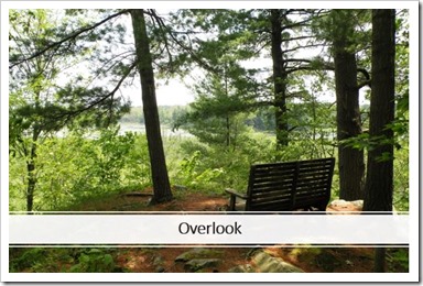 Redwood Hill Preserve. The Redwood Hill Preserve is one of the stunningly beautiful Indian River Lakes (IRL) Preserve trails. It is in Redwood. The main trail is a little over a mile loop (the Seven Oaks Trail) which, by the way, is a very appropriately named trail. There is also a shorter Overlook Trail, and an accessible trail to their beautiful trail side classroom.
http://singercastle.blogspot.com/2018/05/hiking-redwood-hill-preserve.html
Grand Lake Reserve. Indian River Lake Preserve's extremely beautiful Grand Lake Reserve includes several trails with a wide range of trail length, terrain and level of difficulty. Its two trailheads are located in Theresa, and each one takes hikers on some of the most breathtaking views in the area. For first timers we recommend the Grass Lake Overlook Trail. For the more adventurous, the Eagle Marsh Trail is considered the most challenging (including ropes in some spots) with amazing views. Other trails include the Butterfield Lake Trail, and the North Ridge Trail (not currently being maintained).
http://singercastle.blogspot.com/2018/05/hiking-grand-lake-reserve.html
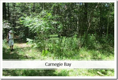 Carnegie Bay Trail: We were shocked to hear of a nature trail located in Alexandria Bay. The Carnegie Bay trail is located on Carnegie Bay Road off of High Street, which is a right turn on Walton Street heading into the Bay from Rt 12E. It was created through a NYS Environmental Protection Fund grant. It starts in an open meadow filled with wildflowers, and then breaks off in several directions taking the hiker on a little over two miles of wandering and looping trails.
http://singercastle.blogspot.com/2018/07/hiking-carnegie-bay-trail.html
Otter Creek Preserve. Otter Creek is another TILT property with over two miles of trails wandering through a variety of terrains. It is located just outside of Alexandria Bay. There is an amazing suspension bridge, a lookout tower, and accessible trails for all levels of hikers. 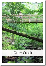
http://singercastle.blogspot.com/2018/03/hiking-otter-creek.html
Keewaydin State Park. We have walked the lovely half mile shoreline trail a number of times. We were quite surprised when we visited again recently and discovered that the trail now continues on for another mile or so through a beautiful forest, ending back behind the pool. It is so new we didn’t see a trailhead yet but well marked and well worth the hike!
http://singercastle.blogspot.com/2018/08/hiking-keewaydin-state-park.html
Coyote Flats State Forest. This State forest is located just off of the Theresa exit of Rt 81. It is over 550 acres but has a 1 mile accessible trail through the middle of the forest making for a lovely 2 mile hike on a well maintained gravel trail in the deep woods. It is easy to find, easy to hike, and a great starter trail for those looking to get started (or anyone else).
http://singercastle.blogspot.com/2018/07/hiking-coyote-flats-state-forest.html
Wellesley Island State Park. We never get tired of visiting Wellesley Island State Park because there are so many different trails to hike and unique spots to visit. There are over 10 miles of trails, many of which are open year round. We highly recommend the Middle Trail to the Pond Loop, the Eel Bay trail (with several ancient glacial potholes), the Narrows trail, and for the more adventurous, the East Trail.
http://singercastle.blogspot.com/2018/04/hiking-wellesley-island-state-park.html
Foster-Blake Woods Preserve. TILT’s lovely Foster-Blake Trail is located just to the West of Clayton and is a beautiful hike through a hardwood forest that takes you to a beautiful shoreline view of the river. We estimate the trail to be a little over a mile.
http://singercastle.blogspot.com/2018/06/hiking-foster-blake-preserve.html
Zenda Farms. We were admittedly a bit skeptical about hiking a couple of miles around an open field but ended up having a delightful hike, with a wonderful surprise work of art at the back of the trail. I'll leave it at that.
http://singercastle.blogspot.com/2018/06/hiking-zenda-farms.html
Grass Point State Park. We have enjoyed walking along the short waterfront trail at Grass Point where there are also lovely views of the Rock Island Lighthouse and Thousand Islands Bridge. We noticed another trail cutting through the middle of Grass Point that is also used for snowmobiles in the winter but this trail is not being maintained for hiking. But we expanded our walk by hiking over to the nearby Gals for the biggest ice cream cones in the Thousand Islands.
http://singercastle.blogspot.com/2018/07/hiking-grass-point-state-park.html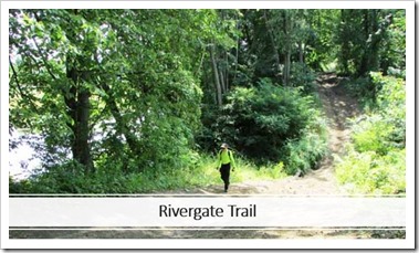
Sissy Danforth Rivergate Trail. I am sure I will need to dedicate a whole column sometime to TILT’s Sissy Danforth Rivergate Trail which includes over 27 miles of former railroad tracks that have been converted to hiking/biking trails. They call it “rails to trails”. And, no, we did not hike all 27 miles. But we discovered you can pick up the trail in a number of different spots for different kinds scenery. Trailheads we explored included Clayton, Redwood, Philadelphia, and Rivergate, but you can pick up the trail just about anywhere along the way. This is still a work in progress with plans for a new TILT preserve following the Rivergate Trail in the near future.
http://singercastle.blogspot.com/2018/07/hiking-sissy-danforth-rivergate-trail.html
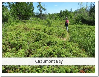 Chaumont Barrens Preserve Trail. This trail is owned and maintained by the world-renowned Nature Conservancy and is described as one of the last and finest examples of alvar grasslands in the world. The preserve is only about 10 minutes south of Clayton and definitely worth the trip. Take Rt 12 to Depauville, take Depauville Road (Rt 125) about 3 miles to VanAlstyne Rd. Parking is on the right. Follow the trail to the kiosk to pick up a brochure for their self-guided tour around an approximately 2-mile loop that includes cancerous pavement barrens, fissures, rubble barren, deciduous limestone woodland, coniferous limestone woodland, and Alvar grassland. This trail was truly amazing!
 http://singercastle.blogspot.com/2018/07/hiking-chaumont-barrens-preserve-just.html
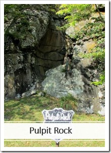
I would like to end our hiking list with a bonus trip we took last summer to a remarkable place just outside of Oxbow, NY. To be honest, we got pretty lost on the way there, partly because one of the roads on the map we were using doesn't exist any longer. But we eventually found our way to the Pulpit Rock State Forest. Because it took so long to get there, we never got to hike the two trails (though we did see both trailheads). What we did get to visit was the adjacent Payne Lake (which has a public access site), and the actual “Pulpit Rock” that the State Forest was named after. Both were well worth the trip, and an excuse for us to go back and hike those trails soon.
https://www.dec.ny.gov/lands/8013.html
We started with a song. Let’s end with another:
For the beauty of the earth,
For the beauty of the skies,
For the love which from our birth,
Over and around us lies…
For the beauty of each hour,
Of the day and of the night,
Hill and vale, and tree and flower,
Sun and moon and stars of light
Lord of all, to thee we raise,
This our grateful hymn of praise.
- “For the Beauty of the Earth” - Folliott Sandford Pierpoint (1864)
We hope you enjoyed our list of Thousand Islands (US) hiking trails and may even have discovered a few potential hikes you had not heard of. We are hoping that some of our friends from across the border can do a Hiking the Thousand Islands Canadian version. In the mean time, happy hiking!
By Patty Mondore
Patty Mondore and her husband, Bob, are summer residents of the Thousand Islands. Patty is an author and a singer/song writer. Her most recent books include River-Lations Revisited: More Inspirational Stories and Photos from the Thousand Islands , River Reflections: A 90-Day Devotional for People Who Love the Water and its two sequels, Nature Reflections and A Bird Lover's Reflections. She and Bob co-authored Singer Castle and Singer Castle Revisited published by Arcadia Publishing, and co-produced "Dark Island's Castle of Mysteries" documentary DVD, in addition to a Thousand Islands music DVD trilogy. Patty is a contributing writer for the "Thousand Islands Sun." Her column, "River-Lations", appears in the Vacationer throughout the summer months. The Mondores are online at www.gold-mountain.com. (Be sure to visit Bob's singercastle.blogspot.com too.)