Written by
Ross D. Pollack posted on September 14, 2008 13:01
Dedication: This fourth online edition and all subsequent editions of “Pollack’s Gazetteer of the Thousand Islands of the United States and Canada in the St. Lawrence River,” are dedicated as a living memorial to Professor Paul H. Malo, of Syracuse University, a great friend and supporter of this project. Paul – along with Ian Coristine – helped launch it by loaning it a great deal of his prized energy and enthusiasm. I feel Paul's presence in every Thousand Islands' vista and every breathtaking sunset. Such a rare and noble individual is best remembered often and in the setting he loved so much – and made his own.
Click here to revisit the page explaining the origins of this project.
Update:
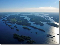
In the almost 11 months since the Island Names Directory behind my Thousand Islands Gazetteer project went live on Thousand Islands Life.com on October 31, 2007, the Gazetteer has taken a turn toward aiding the emergency services providers on the River. Beyond intellectual curiosity, the best reason for distinguishing and locating the 1,865 islands in the first 50 miles of the St. Lawrence River, is to make sure that public safety can be served when there is a fire, a power outage, a navigational accident or a medical emergency on either side of the border.
Click here to visit the updated Island Names Directory.
The time has come not only to update the spreadsheet, but to refresh the notes explaining it. In addition to increasing the number of islands covered in the database, I have added considerable information about other geographical features and landforms on the US and Canadian mainland adjacent to the River (at Paul Malo’s suggestion). And there has been an effort to improve the location information for the listed islands and features.
You will see a new finding aid tied to many of the islands listed: latitude and longitude for the upper right corner of two-minute by two-minute boxes containing named islands. That way, you can quickly see where in the 50-mile run of the River an island or feature is located.
To give location data more prominence, I have moved much of the map information to Sheet 2 of the Excel spreadsheet that appears online. But Sheet 2 is not just a new home for the map data columns. It has been rearranged to show on which map sheet of which series an island appears. The Gananoque Boat Line (GBL) and TIARA map data for Canada is continued, but the main map series featured are the US Geological Survey’s 7.5 Minute topographical sheets, the US National Oceanographic and Atmospheric Administration’s (NOAA) navigational charts, the Natural Resources Canada 1:50,000 topographic map series, and the Canadian navigational charts (data to be added later this year).
To keep the Excel file readable, I have moved the second alphabet of island and feature names – the one containing former, additional, alternative and informal names -- to Sheet 3. It remains cross-referenced to the main island alphabet that is the backbone of Sheets 1 and 2. I thank our Webmaster, Mike Franklin, for executing these and all prior postings, updates and revisions.
As prior visitors know, I originally set these Web pages up to aid me in readying my Gazetteer for print publication. That still remains a dream, but the primary usefulness of my database seems to be to government agencies providing emergency services to people and places on the River.
The appeal to individual users seems to be met by online access through Thousand Islands Life.com. However, one or more of the government agencies which utilize its information to perform their duties may be able to sponsor a print edition for internal distribution and to give to allied and constituent agencies. Other copies would be available to the public. Time will tell.
Finally, those who have assisted me are acknowledged below. It is a growing list of people who have written with information, corrections, family histories, anecdotes and other things that keep this project accurate and also human and wonderful for me. You are invited to join them by sending me an e-mail at yalescribe@att.net. I’m looking forward to hearing from you, especially as to whether this reorganization of Directory content is helpful.
--- Ross David Pollack, September 13, 2008
Thank you so very much:
| Bud Andress |
Decil Stevens |
Reverend Harvey Jones |
| Steve Beste |
Caroline Larson |
Kathy (Nichols) Halsey |
| Daniel W. Grinter |
Joanne Kruize |
Kristi Kenworthy |
| Bill Jackson |
Susanne Duclon |
Julie Bretschger |
| Sue March |
Brian Berghuis |
John Tennity, DPM |
| Susan W. Smith |
Peggy Blackmer |
Jack Parsell |
| Paul Malo |
Sidney Manes |
Ottoleo Kuter-Arnebeck |
| Ian Coristine |
Willa Baynard |
Marilyn Colangelo |
| Dr. Dick Withington |
Sandy Buerkle |
Marlee Sherry |
| Bill Strodel |
Michael Laprade |
|