Editor’s Note: In early August I gave a presentation at the Cornwall Bros. Store Museum in Alexandria Bay on Place Names in the Thousand Islands. One of the questions I was sure to be asked was, “How the American Thousand Islands are Named and Renamed?” To find the answer, I went to the expert, Ross Pollack, who has been studying and recording Island Names for the past five years. His answer was not only in-depth, it also deserved to be shared. This is his answer to “How the Canadian Thousand islands are named and Renamed?”
From 1897 to 1961, official names of places and features in Canada were selected by the Geographical Names Board of Canada [GNBC], now in Natural Resources Canada, under its various earlier administrative names.
Initially, the provinces and territories were asked to assume an advisory role on names within their jurisdiction (as the States do in the United States), and all Canadian agencies had to recognize and use the official names created or accepted by the GNBC. Thus, the names on federal government maps were authorized through this national committee. But since 1961, responsibility has devolved to the provinces themselves -- except as to Indian reserves, national parks, and military reserves, where it is shared by the relevant federal department and the province where located. For the Canadian Thousand Islands, that province is Ontario.
The GNBC remains as a national coordinating body tasked with developing standard policies for the treatment of names and terminology, promoting the use of official names, and encouraging the development of international naming standards, in conjunction with the United Nations and its counterpart boards in other nations.
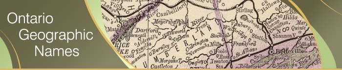
The Role Played by the Province of Ontario
As is true for the US, many places and features in Canada were named many years before the GNBC came into existence, including most of the Thousand Islands in Ontario. A large number of those Island names have since been officially recognized by the Board or by Ontario.
The Ontario Geographic Names Board (OGNB) is the province’s authority for the control and regulation of names and the naming of natural geographic features, unincorporated populated places, localities and other topographic features. According to its Web site, the OGNB reviews all geographic name applications and recommends to the Ontario Minister of Natural Resources “the addition, revision or deletion of official geographic names in English, French and Native languages.” It also sets “principles, policies and procedures for the naming of places and geographic features,” and renders “advice and guidance on the suitability of proposed names for places and geographic features.” Once the Minister approves a new or changed official name, it must be respected by all Ontario and federal agencies.
ONGB membership includes the Surveyor General of Ontario, the Board Secretary appointed by the Minister of Natural Resources, and five persons appointed by the Lieutenant Governor in Council. The Minister appoints one Board member as Chair and a second as Vice-Chair. The Board typically has members expert in surveying, mapping, and cartography, geography, history, French and native languages.
The Ontario Geographic Names Data Base
This database contains the official geographic names for Ontario and only official names are approved for use in government produced maps, charts, gazetteers, signage, and publications in Ontario. It contains French equivalent names, geographic coordinates, township references and information on the origin and official naming history of a name. Ontario’s official geographic names and extents are available to other government ministries, and available to the public through Land Information Ontario Warehouse, by signing an Unrestricted Use License.
However, casual users may access official geographic names for Ontario through the Web site of:
The Canadian Geographical Names Data Base (CGNDB)
The Canadian Geographical Names Data Base (CGNDB) at Natural Resources Canada is the repository for official names records, containing some 350,000 names recognized by the GNBC.
Since 1994, the CGNDB can be queried in real time over the Internet. Previously sold to requesters, a number of digital data sets are now available without cost from the GeoBase portal.
You can search for the Canadian Thousand Islands by name, entering the following data into an onscreen form:
1. Key in a Canadian geographical place name: Wolfe or Hill Island
2. Choose feature type(s): Island or Shoal
3. Choose the type of GeoNames query: Current or Formerly Official
4. Choose a Province or Territory: Ontario
5. Group query results by: Geographical Name
6. Output Options: Standard View
|
You can also query by coordinates or by Bounding Box, a latlong-delimited rectangle. “By coordinates” allows you to pick a point and find all officially named islands within a radius of that point. “Bounding Box” allows you to specify latlong data (coordinates in degrees and minutes) of the North-West corner and South-East corner of a rectangular region, and retrieve a list of all officially named islands in that rectangle.
Searching by alphabetical list is another alternative, but precise spelling is needed to be sure that you will find an Island’s official name.
How to File a Proposed Canadian Thousand Island Name Change
Individuals or agencies that would like to propose a new official Canadian Thousand Island name, or change an existing official name for one of the Islands, must review the Ontario Geographic Names Board Principles and Procedures, and complete, sign and submit the Geographic Names Submission Form.
All applications for a new name or a revision to an existing name are reviewed by the OGNB, which meets no less often than three times a year. The Board stresses that proposals may require extensive investigation before a decision can be made. They also emphasize that submitting sufficient documentation of the proposed name’s suitability and of local support for its use can greatly shorten the processing time needed.
Obviously, I would appreciate hearing from any reader who embarks on the name-change journey, both for reasons of personal curiosity about how smoothly the process works and to make certain that any approved name changes are captured for my Thousand Island Gazetteer database, the next online edition of which will be available on ThousandIslandsLife.com soon.
By Ross David Pollack. Copyright 2011© All Rights Reserved
Ross D. Pollack, a contributor to Thousand Islands Life.com since 2007, is a writer and communications consultant based in the Hudson Valley of New York. Ross was Intranet Editor for IBM’s Personal and Printing Systems Group. His work has appeared in the New York Times Book Review, USA Today, The Royal Gazette of Hamilton, Bermuda, and various local Hudson Valley and Westchester County, NY, newspapers and magazines. He is a member of the District of Columbia Bar, a former US Court of Appeals law clerk, and a former JAG Officer in the US Naval Reserve.